 Exporting and Importing Location Graphics
Location Graphics coordinates may be exported, edited, and re-imported for the purpose of editing their names and/or geographic coordinates. They may not be added by importing them.
Exporting - To export the current list of location graphics, click the Print
button( ) in the upper-right corner of the page.
Select the Export Current View option. CyberAudit-Web will bring up the browser's Save dialog
to save the file as "locGfx.csv". It is exported as a comma separated values(.csv) text file.
This file may then be edited with a text editor.
) in the upper-right corner of the page.
Select the Export Current View option. CyberAudit-Web will bring up the browser's Save dialog
to save the file as "locGfx.csv". It is exported as a comma separated values(.csv) text file.
This file may then be edited with a text editor.
Note: When using programs such as Microsoft Excel, use the "Import" function rather than a direct file open. This enables declaring the type of each column (text vs. number) and will preserve any leading zeroes in text fields.
Fields are exported in the following order:
| Field no | Field Name | Max size | Details |
| 1 | Graphic ID | The internal reference number used by CyberAudit-Web. | |
| 2 | Graphic Name | 64 | The name of the graphic image |
| 3 | Upper Left Corner Latitude | -90.000000 to 90.000000 | The degrees of latitude expressed as a floating point number (up to 11 decimal places) |
| 4 | Upper Left Corner Longitude | -179.999999 to 180.000000 | The degrees of longitude expressed as a floating point number (up to 11 decimal places) |
| 5 | Upper Left Corner Elevation | Any number - Default=0 | Elevation may be entered if desired but is not necessary unless the graphic represents a vertical surface. |
| 6 | Upper Right Corner Latitude | " | " |
| 7 | Upper Right Corner Longitude | " | " |
| 8 | Upper Right Corner Elevation | " | " |
| 9 | Lower Left Corner Latitude | " | " |
| 10 | Lower Left Corner Longitude | " | " |
| 11 | Lower Left Corner Elevation | " | " |
| 12 | Lower Right Corner Latitude | " | " |
| 13 | Lower Right Corner Longitude | " | " |
| 14 | Lower Right Corner Elevation | " | " |
Importing -
Importing location graphics is used to update existing graphic records in the system. It does not add new graphics. Graphics must be exported to get the graphic ID to reference in the import.
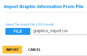
Find the Location Graphic Import page under the Location menu. The file to import must use the format above. Any empty fields will be ignored when the field is imported. The ID and name fields are required. All of the GPS coordinate fields are optional.
For the purpose of importing, all fields use the string datatype. Values are written into the database as they are read; any more than the 14 fields shown above are ignored. Values longer than the max size for the field will be truncated. If there are any errors parsing or inserting the values from a file, all changes made for the file are rolled back.
