 Using Geographic Coordinates with Location Graphics
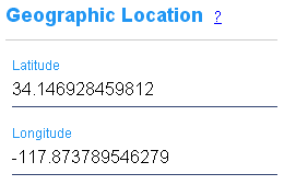
Each item placed on a location graphic may optionally be assigned geographic coordinates as degrees of latitude and longitude.
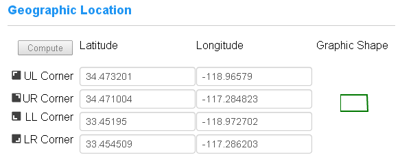
In addition, the corners each location graphic may be assigned a set of coordinates. When an item is placed on one of these graphics its coordinates may then be computed. Or if enough items with coordinates are placed a sufficient distance apart on the graphic CyberAudit-Web can compute the corners of the location graphic.
Notes:
- Geographic coordinates are primarily intended for use with location graphics that represent some part of the surface of the Earth. They are not useful for vertical surfaces.
- CyberAudit-Web can maintain coordinate accuracy up to 12 decimal places.
